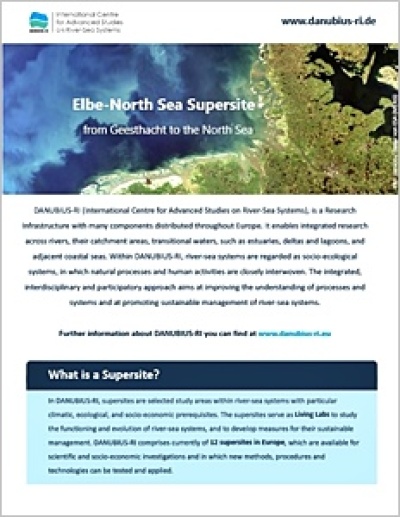
Over centuries human activities have changed considerably the natural and water balance of the Elbe river affecting discharge, various matter cycles and associated ecosystems. These far-reaching measures include the construction of dikes, straightening and engineering the river, construction of weirs, barrages and dams, transfers of water, mining of brown coal, as well as drainage and irrigation of agricultural areas. Furthermore, there are changes due to climate change and various interactions with different measures.
Overview
- Coordination: Helmholtz-Zentrum Hereon, Institute of Carbon Cycles
- Partner: Federal Waterways Engineering and Research Institute, Federal Institute of Hydrology
- Cooperations: COSYNA (“Coastal Observation System for Northern and Arctic Seas”), MOSES („Modular Observation Solutions for Earth Systems“), HCDC (“Helmholtz Coastal Data Center”)
- Extension: from Geesthacht, near the beginning of the estuary, into the German Bight, as far as the influence of the Elbe can be observed, so that the Elbe-North Sea Supersite covers freshwater, transitional and coastal waters, including the Wadden Sea
Challenges
Due to the various uses of the Elbe estuary and the associated areas for living and recreation, for transport, industry and agriculture, there are numerous complex challenges, which are further interacting with climate change:
- Preserve habitats: The Elbe estuary is harbours some highly specialised flora and fauna, as well as some species, which can only be found here. The food web is characterized by a high secondary production, which is used by fish larvae and young fish. The Elbe has the highest fish diversity of all European rivers. However, some fish are dependent to be able to migrate up- and downstream.
- Give more space: Currently, there are 335 km dikes and 17 storm flood barriers, which protect an area over 2400 km², including the city of Hamburg. Therefore the natural retention volume of associated flood plains have been reduced by 8 billion m³.
- Reduce nutrient inputs: Nutrients from the catchment accumulate in the Elbe and lead to a massive growth of microalgae, which are then transported into the estuary. There the microalgae die off and/or are eaten. The leftovers are then degraded by bacteria, which uses oxygen and releases again the nutrients, which contribute to the eutrophication of the North Sea.
- Reduce pollutant inputs: Various pollutants enter the Elbe and are transported with suspended matter, deposit e.g. in the Port of Hamburg and in side arms, and even reach the North Sea. This is a risk for flora and fauna, as well as further human activities.
- Maintain waterway: To allow the passage of big container vessels from the North Sea through the Elbe estuary into the Port of Hamburg and vice versa, the fairway and the harbor basins need to be regularly dredged. Since 2013, the amount of dredged material is continuously increasing. Climate change, river regulation and diking could even further reinforce this trend.
Research Priorities
The aim of this research is to address the above mentioned challenges by analysing, assessing and projecting multiple interactions from different human activities, as well as climate change and extreme events, and their combined effects on biodiversity, functioning and ecosystem services of the Elbe estuary. Therefore the following interconnected research priorities have been identified:
- How are human activities changing the turnover of matter (e.g. nutrients), the oxygen balance, the emission of greenhouse gases (e.g. carbon dioxide, methane, nitrous dioxide), as well as the transport and fate of pollutants?
- What is the effect of changing tides and discharges, sea level rise and river deepening on suspended matter dynamics and sediment balance?
- How is the (ground-) water balance changing, especially within the area of Hamburg, due to precipitation and use in the catchment? How is the hydrodynamic changing, especially within the side areas and at the river mouth?
Services
The Elbe-North Sea Supersite is complementing step by step already existing facilities and activities, as well as data and information systems. For example, a state-of-the art research platform is currently being set up near the beginning of the estuary. Furthermore, the following categories of services are currently being developed:
- Establish and provide access to research facilities and equipment for observation (e.g. research platform Tesperhude and Cuxhaven, research vessels „Ludwig Prandtl“, „Storch“ and „Zwergseeschwalbe“, as well as equipment for sampling, auch as water sampler, filtration system and box corer) and analysis (e.g. FerryBox, ADCP, IRMS, MC ICP-MS), as well as modelling (e.g. high-performance computing);
- Develop and provide access to advanced methods and tools such as methods and standards for sampling and analysis (e.g. several mass spectrometric methods for analysis of elements, non-traditional isotope systems, and stable nitrogen isotopes, as well as laser-based methods for analysis of nitrious dioxide), coupled models (e.g. “from catchment to coast”) and “what if?” scenario applications;
- Generate and provide access to representative data such as earth observation and in situ data (e.g. temperature, pH, dissolved oxygen, salinity, chlorophyll, algal classes, turbidity, CDOM), ex situ data at selected locations, such as Geesthacht and Cuxhaven, as well as along the Elbe estuary (e.g. nutrients, suspended matter, carbon dioxide, methane, nitrious dioxide, metals), and modelled data e.g. filling gaps from observation and analysis;
- Bring together, integrate and provide new knowledge in cooperation with regional and national stakeholders to advance process and system understanding, co-create scenarios and solutions with stakeholders, identify research questions for further observation, analysis and modelling in the Elbe-North Sea Supersite;
- Exchange and support with/from experts to bundle interdisciplinary expertise, to enhance knowledge exchange, to conduct research projects and theses together, as well as to provide training regarding observation, analysis and modelling in the Elbe-North Sea Supersite.


